SOLD!!! WYOMING 40 ACRES LOCATED IN Rochelle / RINER RANCH - $27,995.00 / $995.00 DOWN - ID#W33-2489-25DC
$995.00995.00Details
WYOMING 40 ACRES LOCATED IN ROCHELLE/ RINER RANCH PROPERTY ID: #W33-2489-25DC
Legal Description: The NW 1/4 of SW 1/4 of Section 33 Township 24 North, Range 89 West, 6th PM Carbon County.
Price and Terms: $27,995 / Down Payment of $995.00
Balance of $27,000.. payable at $275.00 Per Month 8.5% APR Loan is amortized approximately 166 months.
Questions?
Contact: Sam Mills at (714) 667-7870
or email at land@acreage4less.com
RINER RANCHES GENERAL AREA OVERVIEW
Description/Zoning:
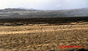
The land is raw, remote acreage. It is flat to gentle rolling terrain covered with sage and grass vegetation. There are NO utilities; No Homeowner Services and NO publicly maintained roads. This Land is NOT suitable for the building of a residence. The property is currently zoned for what could be described as "Agricultural District": Some of the Permitted Uses "include farming, ranching, grazing, dairying, animal or plant husbandry or any other agricultural use". A residence may be permitted if it qualifies as "permitted assessory uses" and complies with conditions set forth by the county.
Location:
The RINER RANCH ACREAGES are located in South Central Wyoming, in the general area of the Great Divide Basin Area of Sweetwater County, approximately 17 miles Northwest of Rawlins and East of Hwy 287.
USE: Use the property to hunt, hike, camp, horseback ride, future speculation purposes, or as an asset to pass on to the children or grandchildren.
Carbon County:
Carbon County offers a multitude of adventures and stands out as a microcosm of the OLD WEST itself. For the wildlife enthusiast, one can find deer, elk, antelope, black bear, varmints, mountain lions, big horn sheep, and a variety of upland birds and waterfowl. The area also provides some of the most beautiful scenery to be found in the United States.
Access:
The general area is accessed via Mineral Exploration Road. The parcels available for purchase have reserved access easements across private lands. Access across the BLM Lands, on an occasional basis or over existing roads, to private lands is allowed by BLM's policy. The BLM publishes a booklet specifically addressing the issue of easements.
Property surveys:
We have not had surveys done on the properties, unless specifically noted. The U.S. Government surveyed the area at one time, and marked many section corners utilizing brass caps, and/or other types of monument markers. However, over the course of time, the survey markers tend to become covered by dirt, overgrown with vegetation or maybe destroyed. But you can still find many of them, if you know where and what to look for. We will supply you with specific information that will get you to the property.
Water:
This was part of an old grazing ranch and there very few wells drilled in the area. You can obtain information regarding water wells from the State of Wyoming Water / Engineering office at (307) 777-7354. We do not guarantee the success of a water well and have no estimate as to the costs.
Mineral Rights:
The mineral rights were reserved by the railroad, or their subsidiary. Currently there is no active drilling or exploration on the properties, we are offering for sale. However this could change. It is the policy of the railroad to provide the private landowners with surface damage agreements. These agreements compensate the landowners based on a percentage (royalty) of the extracted gas /oil / minerals.
Property Taxes:
The annual property taxes are currently less than $100.00 per year for an entire 40 acre parcel.


